
Global Listening: Hydroacoustics for Nuclear and Ocean Study
How a Cold War-era monitoring network called the International Monitoring System uses hydroacoustic sensors buried in the ocean floor to detect clandestine nuclear tests anywhere on Earth — and what it accidentally records along the way.
A Treaty Without Teeth That Built a Global Ear
In September 1996, the United Nations General Assembly adopted the Comprehensive Nuclear-Test-Ban Treaty, or CTBT. The treaty banned all nuclear explosions, whether for military or civilian purposes, in every environment on Earth. It was a landmark diplomatic achievement, representing decades of arms control negotiation and the accumulated pressure of public opposition to nuclear testing that had grown steadily since the atmospheric tests of the 1950s and 1960s. But the treaty had a fundamental problem baked into its architecture from the very beginning: how do you actually verify that countries are complying, especially when a nation might detonate a device deep underground, beneath the ocean, or in a remote desert thousands of kilometers from any human observer?
The answer came in the form of one of the most sophisticated and least-discussed surveillance systems ever constructed: the International Monitoring System, or IMS. Run by the Comprehensive Nuclear-Test-Ban Treaty Organization, known as the CTBTO and headquartered in Vienna, Austria, the IMS consists of 337 monitoring facilities spread across every continent and ocean basin on Earth. It uses four distinct detection technologies — seismic, hydroacoustic, infrasound, and radionuclide monitoring — to listen for the signatures of nuclear detonations anywhere on the planet. Of these four technologies, the hydroacoustic network is perhaps the strangest and most counterintuitive, exploiting a quirk of ocean physics that was first understood by the United States Navy during World War II and kept classified for decades afterward.
What makes the hydroacoustic component particularly remarkable is not just its sensitivity, but the breadth of phenomena it inadvertently captures. A system designed to catch the signature of a forbidden weapon has become one of the most versatile scientific instruments on Earth, and the story of how that happened touches on submarine rescue operations, Antarctic glaciology, deep-sea volcanism, and the acoustic ecology of whales.
The SOFAR Channel: A Natural Acoustic Superhighway
At a depth of roughly 600 to 1,200 meters below the ocean surface, depending on latitude, temperature, and salinity, there exists a permanent acoustic channel in the world’s oceans. It is called the Sound Fixing and Ranging channel, universally known as SOFAR. The channel forms due to the combined and competing effects of water temperature and pressure on the speed of sound in seawater. Near the surface, warmer water transmits sound faster. As depth increases and temperature drops, sound slows down. But below the thermocline — the boundary layer where temperature decreases rapidly with depth — increasing hydrostatic pressure begins to dominate the physics, speeding sound back up again. The minimum speed point, the depth at which sound travels most slowly, forms a natural waveguide. Sound waves entering this layer refract back toward it rather than dispersing outward into the surrounding water column, allowing acoustic energy to travel extraordinary distances with minimal attenuation.
The practical consequence of this physical arrangement is almost difficult to believe. A relatively small acoustic event at SOFAR depth can be detected by instruments thousands of kilometers away. The channel acts like a pipe, directing sound energy horizontally around the globe rather than allowing it to spread spherically and lose intensity according to the inverse-square law that governs sound in open media. In the deep ocean, certain frequency ranges can travel from one side of an ocean basin to the other with enough energy remaining to be detected by sensitive instruments.
The U.S. Navy discovered the practical implications of this channel in the 1940s. A downed pilot could drop a small explosive charge designed to detonate at SOFAR depth, and the resulting sound could be detected by hydrophones stationed thousands of kilometers away, allowing rescuers to triangulate the pilot’s location from the time differences between arrivals at multiple listening posts. The same principle was subsequently applied to tracking Soviet submarines during the Cold War. By the 1950s, the Navy had built the Sound Surveillance System, known as SOSUS, a classified network of bottom-mounted hydrophones cabled to shore stations positioned strategically across the Atlantic and Pacific. The existence of SOSUS was not publicly acknowledged until 1991, when the Navy declassified the program and began allowing oceanographers limited access to its infrastructure and historical data.
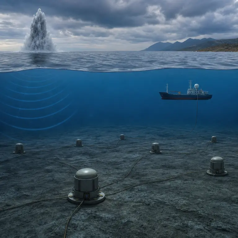
The CTBTO’s hydroacoustic network, built from 1996 onward as the IMS was assembled, works on the same physical principle. It consists of eleven hydroacoustic stations positioned around the world to provide overlapping coverage of all major ocean basins. Six of these are hydrophone stations, where instruments are actually submerged within the SOFAR channel and connected by undersea cables to land-based data acquisition centers. The other five are T-phase stations, which detect the seismic conversion of hydroacoustic waves as they strike island coastlines and transfer their energy into the solid earth, where conventional seismometers can record them. Together, the eleven stations can theoretically detect an underwater explosion equivalent to just a few kilograms of TNT anywhere in the world’s oceans, a sensitivity that far exceeds what is needed to detect a nuclear device.
What the Network Actually Hears
The hydroacoustic monitoring network was designed with a single purpose: catching clandestine nuclear tests. But because it operates continuously, around the clock, every day of the year, with extraordinary sensitivity across a broad frequency range, it records a vast and largely unplanned archive of sounds that no treaty negotiator in 1996 could have fully anticipated. Scientists with access to IMS data have used it to study phenomena ranging from submarine volcanic eruptions to iceberg dynamics in Antarctica, and the network's secondary scientific value has grown steadily as researchers have found new ways to interrogate its data.
In 1999, hydroacoustic stations detected the sounds of an underwater volcanic eruption along the Gakkel Ridge in the Arctic Ocean, one of the most remote and least-studied spreading centers on Earth. The ridge runs beneath the Arctic basin at depths where direct observation is essentially impossible with conventional oceanographic methods, and the eruption would have gone entirely undetected without the acoustic record. The IMS data allowed researchers to confirm magmatic activity and estimate the location and approximate scale of the event, contributing to a revised understanding of volcanic activity at ultra-slow-spreading ridges. Similarly, the network has tracked the acoustic signatures of large icebergs grinding against the seafloor in the Southern Ocean, producing a characteristic tremor that can be distinguished from tectonic or explosive events through careful waveform analysis.
Perhaps the most widely reported civilian application of the hydroacoustic network came in November 2017, when the Argentine submarine ARA San Juan disappeared in the South Atlantic with 44 crew members aboard. An anomalous signal detected by IMS hydroacoustic stations was subsequently determined to be consistent with an implosion event at the submarine’s last known position. The signal lasted less than a second and had the sharp, broadband character associated with a catastrophic structural failure rather than an explosion or seismic event. The CTBTO shared the relevant data with Argentine authorities, helping searchers narrow the search area considerably. The wreck was eventually located in November 2018 at a depth of approximately 907 meters, confirming the acoustic analysis. The episode demonstrated, in unusually public terms, that the monitoring system’s value extends well beyond its original arms-control mandate, and it drew attention to the IMS among audiences who had never heard of it before.
The Challenge of Discriminating Signal from Noise
The core technical challenge of the IMS hydroacoustic network is not sensitivity. The network hears almost everything that happens in the world’s oceans at relevant frequencies and depths. The challenge is discrimination: distinguishing a clandestine nuclear test from the enormous and continuous background of natural and industrial acoustic noise that fills the ocean environment at all times.
Commercial shipping generates a continuous broadband roar across every major ocean basin, produced by propeller cavitation and engine vibration from tens of thousands of vessels operating simultaneously. Earthquakes and submarine volcanic eruptions produce signals that can superficially resemble explosions in their initial waveform characteristics. Storms generate infrasound that couples into the water column. And marine mammals, particularly blue whales and fin whales, generate low-frequency calls that fall squarely within the frequency bands of greatest interest to nuclear monitoring, at 10 to 100 hertz, and can be detected over hundreds of kilometers.
Analysts at the CTBTO’s International Data Center in Vienna use a combination of waveform analysis, frequency content, signal duration, source localization, and cross-correlation between multiple stations to classify events. A genuine underwater nuclear explosion would produce a sharp, broadband pulse with a characteristic spectral shape, followed by a distinctive feature known as a bubble pulse. This secondary oscillation is caused by the rapid expansion and contraction of the superheated gas cavity created by the detonation: the cavity expands under the enormous pressure of the explosion, overshoots equilibrium, then collapses and re-expands in a series of damped oscillations whose period is directly related to the energy yield of the explosion. This bubble pulse signature is essentially impossible to fabricate and extremely difficult to suppress through containment measures, making it one of the most reliable discriminants available to analysts.
When North Korea conducted its sixth nuclear test in September 2017, the IMS seismic network detected the event within minutes. The hydroacoustic network, which is less directly relevant for underground tests conducted far from water, nonetheless contributed to the overall multi-technology analysis. The CTBTO issued a public statement confirming an unusual seismic event consistent with a nuclear explosion before any national government had made an official public attribution, illustrating the speed and independence of the monitoring system.
A Dual-Use Archive of Earth’s Acoustic History
Beyond arms control and disaster response, the IMS hydroacoustic data represent something no one fully anticipated when the treaty was negotiated in the mid-1990s: a continuous, global, long-term acoustic record of the planet’s oceans, accumulating without interruption over decades. The scientific value of such a record compounds over time in ways that are difficult to predict in advance, because many of the most important applications of long-term environmental datasets emerge only after the data has been collected for long enough to reveal trends.
Climate researchers have begun using the data to track changes in ocean temperature, exploiting the direct relationship between water temperature and the speed of sound. By measuring how long it takes for known acoustic sources — controlled transmissions from research vessels or signals from repeating natural sources — to travel between fixed stations, scientists can infer the average water temperature along the entire acoustic path. This technique, called acoustic thermometry or ocean acoustic tomography, allows researchers to measure bulk ocean warming across entire ocean basins simultaneously, complementing the point measurements provided by floats and moorings. The IMS stations, positioned to maximize monitoring coverage, also provide acoustic paths that are scientifically useful for this application.
The network has also contributed to the emerging field of passive ocean acoustics, which uses the ocean's ambient sound to study everything from fish spawning aggregations to the behavioral impacts of industrial noise on marine mammals. Long-term records from IMS stations have enabled researchers to document changes in ambient noise levels associated with increased shipping traffic and to track seasonal and geographic patterns in biological sound production that would otherwise be invisible without continuous monitoring. The overlap between arms control infrastructure and environmental science was not planned, but it has proven to be one of the more productive unintended consequences of the post-Cold War arms control enterprise. The CTBTO has actively encouraged this secondary use of its data, making portions of the IMS dataset available to accredited researchers through its virtual data exploitation center, and the scientific community has responded with a growing body of work that uses the network in ways its designers never envisioned.
The hydroacoustic network remains one of the few genuinely global, continuously operating scientific instruments on Earth, comparable in scope and ambition to the global seismic network or the GPS reference station network that underpins modern geodesy. It was built to prevent nuclear war by making clandestine testing detectable. Along the way, it has become an indispensable tool for understanding the ocean environment of the planet it was designed to protect, listening not just for the sounds of weapons but for the quieter, more complex sounds of a changing world.
Sources & Further Reading
- Comprehensive Nuclear-Test-Ban Treaty Organization. "The International Monitoring System." CTBTO Preparatory Commission, 2023. https://www.ctbto.org/monitoring-verification/the-ims-monitoring-network/
- Munk, W., and Forbes, A.M.C. "Global Ocean Warming: An Acoustic Measure?" Journal of Physical Oceanography, 1989.
- Sounds in the Sea: From Ocean Acoustics to Integrated Ocean Observing. National Academies Press, 2003. https://nap.nationalacademies.org/catalog/10566
- Vogt, P.R., and Jung, W.Y. "Hydroacoustic events recorded at IMS stations and their geophysical significance." Pure and Applied Geophysics, 2002.