
Unveiling Antarctica: Hidden Landscapes Shape Future Seas
How a 1950s Antarctic seismic experiment accidentally revealed that the ice sheet conceals a landmass larger than Europe, reshaping geopolitics, geology, and the future of sea-level science.
Ice as a Disguise
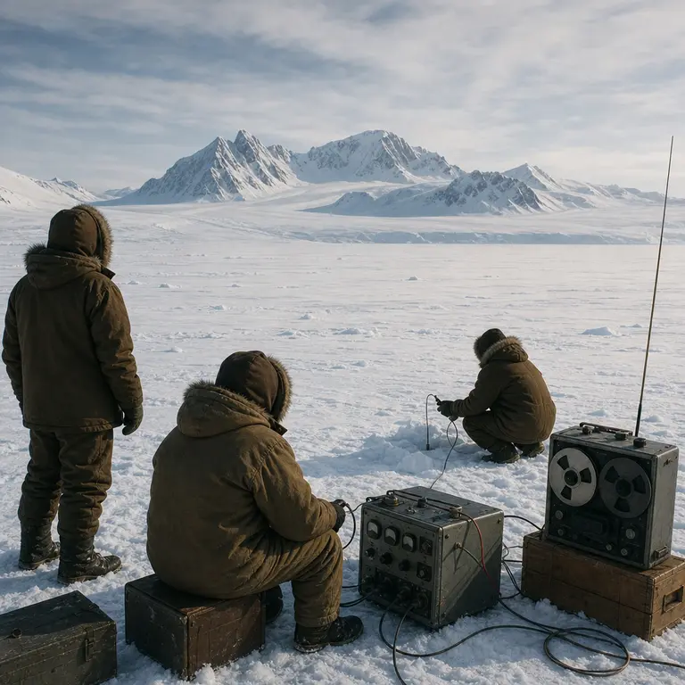
Antarctica is commonly described as a continent, but that description conceals a stranger truth. What explorers first reached in the nineteenth century was not land in any ordinary sense. It was a moving, grinding, kilometers-thick shell of ice sitting atop terrain that had been invisible to science throughout recorded history. The bedrock beneath the Antarctic Ice Sheet remained essentially unmapped until the International Geophysical Year of 1957 to 1958, when coordinated seismic sounding campaigns fired explosive charges into the ice and timed the returning echoes. What emerged from that data was astonishing: a subglacial continent of extraordinary complexity, buried beneath an average of 2.16 kilometers of ice, with mountain ranges, deep basins, and valleys rivaling those on Earth's surface.
The subglacial landscape is now known as Bedrock Antarctica, and its detailed mapping has become one of the most consequential scientific projects of the twenty-first century. The stakes are not academic. The geometry of the rock beneath the ice determines how fast glaciers slide toward the ocean, which in turn determines how quickly sea levels will rise as the climate warms. Yet for most of human history, this terrain was not merely unexplored. It was entirely unsuspected. The idea that a continent could be effectively fictional, present in name but absent in any meaningful physical sense, is one of the more disorienting revelations of modern earth science. Antarctica as a landmass is, in a very real sense, a recent discovery, and the full picture of what lies beneath remains incomplete even today.
Bedmap and the Architecture of Hidden Terrain
The project that transformed fragmentary seismic readings into a coherent map is called Bedmap and is coordinated by the Scientific Committee on Antarctic Research. Its third iteration, Bedmap3, released in 2023, synthesized over 27 million measurements of ice thickness gathered by airborne radar, seismic surveys, and satellite gravity data accumulated over seven decades. The resolution of the resulting map is fine enough to reveal individual subglacial valleys a few kilometers wide, a level of detail that would have been unimaginable to the scientists who detonated the first charges into the ice during the International Geophysical Year.
What the map shows is deeply counterintuitive. West Antarctica, the smaller lobe of the continent, sits in a bowl. Much of its bedrock lies below sea level, in some places more than 2,500 meters below it. This configuration is called a marine ice sheet, and it is inherently unstable in a warming world. Once warm ocean water finds its way beneath the ice at the grounding line, where ice meets bedrock and ocean, it can melt the ice from below in a process that is difficult to reverse. The Thwaites Glacier, sometimes called the Doomsday Glacier, sits in exactly this kind of retrograde basin, meaning its bed deepens as you move inland. If the grounding line retreats far enough, the glacier could enter a self-sustaining collapse that no reduction in emissions could halt.
East Antarctica, by contrast, sits on a much older and more stable craton, a rigid ancient rock platform, but even there the map revealed surprises. The Aurora Subglacial Basin and the Wilkes Subglacial Basin are enormous depressions holding ice that, if melted, could raise global sea levels by several meters independently of anything happening in the west. The Gamburtsev Subglacial Mountains, discovered during the same International Geophysical Year that first probed the ice, present perhaps the strangest case of all. They rise to nearly 3,000 meters, comparable in scale to the European Alps, yet they sit entirely beneath the ice and were unknown to geology until the middle of the twentieth century. Their origin remains debated. Most mountain ranges of that size bear the scars of glacial erosion, but the Gamburtsevs appear remarkably well-preserved, suggesting the ice formed over them so rapidly that it protected them rather than carved them. They are mountains that have never been seen, and may never be, yet their shape influences the flow of ice above them in ways that feed directly into sea-level projections.
The Ghosts of Ancient Rivers
One of the more eerie findings from radar sounding campaigns is the presence of enormous ancient river systems carved into the bedrock long before the ice arrived. A 2023 study published in Nature used ice-penetrating radar flown by British Antarctic Survey aircraft to reveal a fossilized river network beneath the East Antarctic Ice Sheet stretching roughly 1,000 kilometers. The channels are up to 1.5 kilometers deep and appear to have formed around 34 million years ago, when Antarctica transitioned from a forested, temperate continent to the frozen world it is today. The transition was geologically rapid, driven by the opening of the Drake Passage between Antarctica and South America, which allowed the Antarctic Circumpolar Current to form and thermally isolate the continent from warmer ocean waters. The rivers that once drained a green and living landscape were simply swallowed by the advancing ice, preserved in the rock like a photographic negative of a world that no longer exists.
These ancient rivers matter for a practical reason. Their valleys act as conduits, channeling subglacial meltwater toward the ocean. Subglacial water is not a curiosity. It lubricates the base of the ice sheet and dramatically affects how fast glaciers flow. More than 670 subglacial lakes have been identified beneath Antarctica, connected by a hydrological network that pulses and drains in ways scientists are still learning to model. Lake Vostok, the largest, is roughly the size of Lake Ontario and has been isolated from the surface for at least 15 million years. When Russian scientists finally drilled into it in 2012 after more than two decades of effort, the water that refroze in the drill bore contained microbial DNA, though the question of whether it represents genuinely ancient isolated life or contamination from the drilling process remains actively debated.
The implications of that debate extend well beyond Antarctica. If microbial life can survive for millions of years in a cold, dark, high-pressure lake entirely cut off from sunlight and surface chemistry, it strengthens the case for life in analogous environments elsewhere in the solar system. Europa, one of Jupiter’s moons, and Enceladus, orbiting Saturn, both harbor subsurface oceans beneath icy shells. The subglacial lakes of Antarctica have become, in the minds of some astrobiologists, the closest natural laboratories humanity has for understanding what those alien oceans might contain. The hidden continent is not only a key to Earth’s future coastlines. It is also a testing ground for some of the most profound questions in biology.
What the Bed Tells Us About Future Oceans
The most urgent application of subglacial mapping is feeding it into ice sheet models that project future sea-level rise. The Intergovernmental Panel on Climate Change’s Sixth Assessment Report, published in 2021, acknowledged that the uncertainty range for Antarctic contributions to sea-level rise by 2100 is wider than for any other source, spanning from a few centimeters to more than a meter depending on which ice dynamics scenarios are used. The bedrock geometry is a primary reason for that uncertainty. A glacier resting on a flat or landward-sloping bed behaves very differently from one sitting in a retrograde basin, and the difference between those two configurations can translate into meters of global sea-level rise over the course of a century.
A phenomenon called glacial isostatic adjustment adds another layer of complexity. When ice melts, the bedrock beneath it slowly rebounds upward, relieved of its enormous weight. In most parts of the world, this process takes thousands of years because the mantle beneath the crust is viscous and flows slowly. But in parts of West Antarctica, the mantle is unusually warm and fluid, meaning rebound could happen over centuries rather than millennia. A faster-rebounding bed changes the slope at the grounding line in ways that could partially stabilize an otherwise retreating glacier. Whether this effect is large enough to matter meaningfully for Thwaites is one of the most actively researched questions in glaciology right now, and the answer depends critically on knowing the precise composition and thermal properties of the rock that lies, inaccessible and lightless, beneath kilometers of moving ice.
There is something philosophically vertiginous about the situation. The future of coastlines in Bangladesh, Florida, the Netherlands, and Vietnam may hinge on the detailed geometry of a landscape that no human being has ever seen and that the overwhelming majority of people alive today do not know exists. The hidden continent beneath the ice is not a passive stage. It is a dynamic participant in the future of the world’s coastlines, and the better scientists understand its shape, geology, and ancient hydrological memory, the narrower the uncertainty about what the next century’s oceans will look like. A landmass no human eye has ever seen may ultimately determine where the sea meets the shore for billions of people who will never know its name.
Sources & Further Reading
- Fretwell, P. et al. Bedmap2: Improved ice bed, surface and thickness datasets for Antarctica. The Cryosphere, 2013. https://doi.org/10.5194/tc-7-375-2013
- Burton-Johnson, A. et al. Bedmap3: New datasets for Antarctica. Scientific Committee on Antarctic Research, 2023. https://www.scar.org/science/bedmap/bedmap3/
- Duval, P. et al. Ancient river networks beneath the East Antarctic Ice Sheet. Nature, 2023. https://doi.org/10.1038/s41586-023-05768-0
- IPCC. Climate Change 2021: The Physical Science Basis. Contribution of Working Group I to the Sixth Assessment Report. Cambridge University Press, 2021. https://www.ipcc.ch/report/ar6/wg1/