The Satellite Constellation Rewriting Weather Science
A new generation of radio occultation satellites is transforming atmospheric science by bending GPS signals through Earth's atmosphere to measure temperature, humidity, and pressure with unprecedented precision — revealing phenomena that conventional weather satellites cannot detect.
Introduction
Weather forecasting has long depended on a patchwork of ground stations, weather balloons, and imaging satellites. The science of predicting atmospheric behavior has made remarkable strides over the past century, yet fundamental gaps in observational coverage have persistently limited the accuracy of even the most sophisticated numerical models. Oceans cover more than seventy percent of Earth’s surface, and vast stretches of the polar regions, the tropics, and the developing world remain chronically undersampled by conventional instruments. Into this gap, a quieter revolution has been unfolding in low Earth orbit since the mid-2020s. Constellations of small satellites equipped with radio occultation receivers are harvesting data from GPS and other navigation signals as they bend through the atmosphere, a technique that measures the invisible architecture of the air with a precision that continues to astonish atmospheric scientists. The story of how this technology matured from a niche research curiosity into a global sensing infrastructure is one of the more consequential and least celebrated chapters in the recent history of Earth observation.
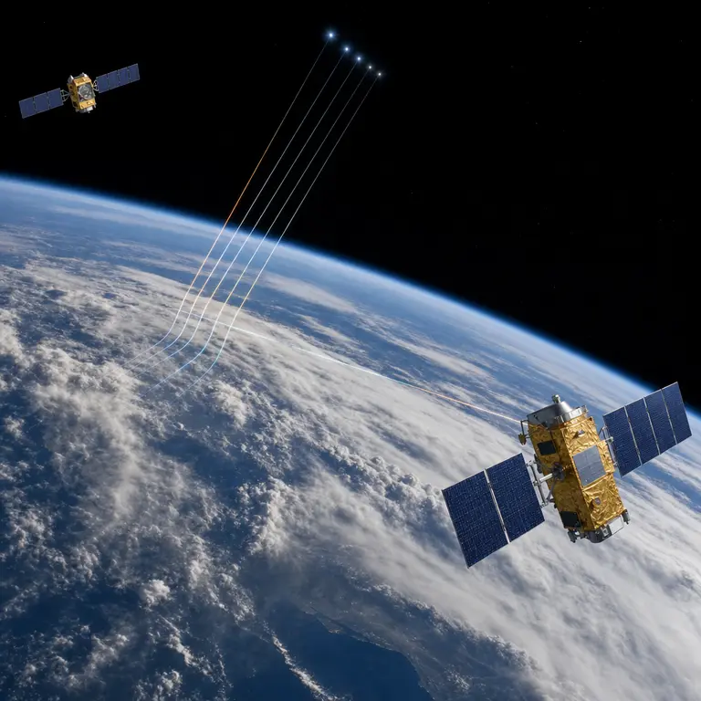
The principle at the heart of radio occultation is elegant. When a GPS signal travels from a transmitting satellite to a receiver in low Earth orbit, it passes through the atmosphere at a grazing angle during the moments of rising and setting relative to the receiver. The atmosphere bends and slows the signal in a measurable way, with denser and more humid layers producing greater refraction. By analyzing exactly how much the signal refracts at each altitude, scientists can extract vertical profiles of temperature, pressure, and water vapor with a vertical resolution finer than 100 meters, something conventional polar-orbiting weather satellites cannot reliably achieve. This technique has been used experimentally since the 1990s, but the commercial miniaturization of satellites over the past decade has transformed it from a laboratory demonstration into a global atmospheric sensing network of extraordinary density and reach.
The COSMIC Lineage and Its Commercial Descendants
The modern story of GPS radio occultation at scale begins with the COSMIC program, a joint mission between the United States and Taiwan launched in 2006 that deployed six microsatellites into carefully chosen orbital planes. The mission was designed as a proof-of-concept, and it delivered emphatically. COSMIC produced roughly 2,500 atmospheric profiles per day and demonstrably improved numerical weather prediction models when its data were assimilated into operational forecasting systems. The results were significant enough to justify a follow-on constellation, COSMIC-2, which launched in 2019 and increased the daily yield to over 5,000 profiles, with coverage concentrated in the tropics where conventional observational data are weakest and where errors in initial conditions propagate most rapidly into forecast uncertainty.
What fundamentally changed the game, however, was the entry of commercial operators into a domain previously the exclusive territory of government space agencies. Companies including Spire Global, GeoOptics, and PlanetiQ have since deployed their own constellations, collectively generating tens of thousands of radio occultation soundings every day by 2024. Spire alone operates over 100 CubeSats distributed across multiple orbital planes, creating a near-continuous global mesh of atmospheric measurements that would have been logistically and financially inconceivable using traditional satellite architectures. The cost per sounding has dropped by roughly two orders of magnitude compared to traditional radiosondes, the instrument packages lifted by weather balloons, while coverage extends uniformly over oceans, polar regions, and developing nations where balloon networks are sparse or entirely absent.
This democratization of atmospheric data carries implications that extend beyond meteorology. For decades, the quality of weather forecasting available to a given country was partly a function of how many weather balloon stations it could afford to operate and maintain. The global coverage provided by commercial radio occultation constellations begins to equalize that disparity, providing high-quality upper-atmosphere data to forecasting centers in regions that have historically operated with the thinnest observational networks. The humanitarian implications of improved tropical cyclone forecasting alone justify serious attention to this shift.
What the Bent Signals Reveal
Radio occultation data are particularly valuable in the upper troposphere and lower stratosphere, a region between roughly 8 and 30 kilometers altitude that plays a critical role in climate dynamics but is notoriously difficult to characterize with other instruments. Satellites observing in the infrared and microwave bands struggle with this region because of overlapping spectral contributions from different atmospheric layers. Weather balloons rarely reach the stratosphere intact, and when they do, the data are available only at the sparse locations where they are launched. Radio occultation sidesteps these limitations by deriving temperature and pressure from the geometry of signal bending rather than from emitted or reflected radiation.
One of the technique’s most scientifically valuable properties is its self-calibrating nature. It requires no external reference standard, which means its measurements are stable enough to detect long-term climate trends, a property that most satellite instruments lack because their sensors drift over time and require periodic recalibration against independent references. This stability makes radio occultation data uniquely suited for climate monitoring, where genuine atmospheric trends must be distinguished from instrumental artifacts.
One of the more surprising findings from the expanding constellation network has been the detection of atmospheric gravity waves at much finer spatial scales than previously mapped. These are not the gravitational waves of spacetime physics detected by instruments like LIGO, but rather buoyancy-driven oscillations in the atmosphere, analogous to ripples spreading across a pond, that transport energy from the lower atmosphere into the stratosphere and influence the behavior of jet streams, monsoon systems, and ozone distribution. The dense vertical profiles from radio occultation constellations have revealed a previously undersampled population of small-scale gravity waves over mountain ranges and coastlines, prompting revisions to the parameterization schemes used in global climate models. These parameterizations, which represent processes too small to be resolved explicitly by model grids, are among the largest sources of uncertainty in long-range climate projections.
The data have also improved the detection and continuous monitoring of the tropopause, the boundary layer separating the troposphere from the stratosphere, at a global scale. Small changes in tropopause height are a sensitive indicator of climate change, rising as the troposphere warms and the stratosphere cools in response to increasing greenhouse gas concentrations. The continuous record now accumulating from commercial constellations is approaching a length sufficient to extract statistically significant trends, offering a new independent line of evidence for monitoring the pace of atmospheric change.
The Forecasting Impact and Future Directions
Meteorological agencies, including the European Center for Medium-Range Weather Forecasts and the United States National Oceanic and Atmospheric Administration, have formally integrated commercial radio occultation data into their operational models, a significant step given the rigorous quality standards these institutions require before incorporating any new data source into systems that governments and aviation authorities depend upon. Studies comparing forecast skill with and without this data show measurable improvements in 24- to 72-hour forecasts, particularly over the Southern Ocean and the Arctic, regions where the scarcity of conventional observations has historically degraded model performance more severely than anywhere else on the planet.
The next frontier involves extending radio occultation to signals from other satellite navigation systems, including Europe’s Galileo constellation, Russia’s GLONASS, and China’s BeiDou. Each additional navigation system multiplies the number of available signal paths and further densifies the measurement network without requiring new transmitting satellites to be launched. Experimental receivers are also being designed to exploit signals from low Earth orbit broadband internet constellations, which transmit at different frequencies and could enable profiling of the lower troposphere, a region where standard GPS occultation loses vertical resolution due to multipath interference from the Earth’s surface. Successfully extending the technique into the lowest few kilometers of the atmosphere would address one of its current limitations and improve forecasting of near-surface weather phenomena.
There is also growing scientific interest in using radio occultation to monitor ionospheric electron density, which affects radio communications and GPS positioning accuracy, and to track the propagation of atmospheric waves generated by volcanic eruptions and large earthquakes. The 2022 eruption of Hunga Tonga-Hunga Ha’apai in the South Pacific produced atmospheric pressure waves of remarkable intensity that circumnavigated the globe multiple times, detectable by barometers worldwide. Commercial radio occultation constellations captured the vertical structure of those waves in a detail that ground-based instruments could not resolve, providing a glimpse of what a fully mature global constellation could offer as a tool for monitoring not just routine weather but extreme and anomalous atmospheric events.
Conclusion
What began as a clever exploitation of signal bending in the 1990s has quietly become one of the most consequential advances in atmospheric observation since the launch of the first meteorological satellite in 1960. The convergence of miniaturized satellite technology, commercial investment, and a physically elegant measurement principle has produced a global sensing capability that fills gaps in Earth observation that persisted for decades. As constellation density continues to grow and new signal sources are incorporated, radio occultation is positioned to move from a supplement to conventional observing systems toward a foundational layer of the global atmospheric observing infrastructure. The sky, it turns out, has been broadcasting its own measurements all along. It simply required the right receivers, placed in the right orbits, to begin listening properly.
Sources & Further Reading
- Anthes, R.A. et al. The COSMIC/FORMOSAT-3 Mission: Early Results. Bulletin of the American Meteorological Society, 2008. https://doi.org/10.1175/BAMS-89-3-313
- Schreiner, W.S. et al. COSMIC-2 Radio Occultation Constellation: First Results. Geophysical Research Letters, 2020. https://doi.org/10.1029/2019GL086841
- Spire Global. Atmospheric Science from Commercial CubeSat Constellations. Spire Global Technical Overview, 2023. https://spire.com/weather
- European Centre for Medium-Range Weather Forecasts. Use of Radio Occultation Data in Operational NWP. ECMWF Technical Memoranda, 2022. https://www.ecmwf.int