Unveiling Silent Earthquakes: Slow Slip and Tremor Events
Deep beneath subduction zones, silent earthquakes release enormous energy over days, months, or years — invisible to humans but detectable by GPS, and potentially linked to catastrophic megaquakes above.
Introduction
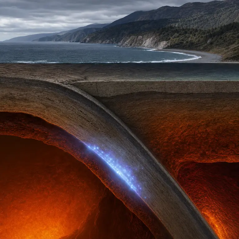
Every schoolchild learns that earthquakes are sudden, violent events — the ground shakes, buildings collapse, and the moment passes in seconds. But beneath certain coastlines around the world, a stranger kind of earthquake unfolds in slow motion, releasing energy equivalent to a magnitude 6 or 7 event over days, weeks, or even years. No one feels a thing. No seismometer needle swings wildly. Yet the ground moves, plates shift, and stress accumulates in ways that may ultimately determine when and where the next great rupture occurs.
These events, called slow slip events or silent earthquakes, were discovered in the late 1990s and fundamentally changed how geophysicists understand the behavior of tectonic plate boundaries. They represent one of the most consequential and least publicly known developments in modern earth science. To appreciate why they matter, it helps to understand not just what they are, but also how they were found, what they reveal about the hidden mechanics of the planet, and what they might eventually tell us about catastrophic earthquakes yet to come.
How GPS Revealed What Seismometers Missed
The story of slow slip begins with a technological accident of perception. Traditional seismometers detect the rapid oscillations of seismic waves — energy that travels through rock at thousands of meters per second. A slow slip event, by definition, moves too gradually to generate those waves at detectable frequencies. For most of the twentieth century, the events were simply invisible to the instruments scientists had. They were not hiding in plain sight so much as hiding in a frequency range that no existing tool could register.
That changed when geodetic GPS networks became dense and precise enough to measure ground deformation at the millimeter scale. In the late 1990s, researchers monitoring the Cascadia Subduction Zone — the fault system running offshore from northern California through Oregon, Washington, and into British Columbia — noticed something extraordinary in the GPS data. Every fourteen months or so, a cluster of GPS stations would shift slightly landward, reversing the slow seaward creep that normally accumulates as the Juan de Fuca plate grinds beneath North America. The reversal lasted one to two weeks, then stopped, only to repeat again like clockwork.
The first rigorous description of the phenomenon was published by Herb Dragert and colleagues at the Geological Survey of Canada in 2001, in the journal Science. They calculated that the energy released during a single Cascadia slow slip event was equivalent to a magnitude 6.7 earthquake — yet no one had felt a tremor, and no seismograph had recorded a conventional quake. The plates were slipping silently, somewhere between 25 and 45 kilometers depth, in a zone too warm and plastic to store elastic energy in the way that generates sharp ruptures.
What made the discovery so striking was not just the phenomenon itself, but the implication that entire categories of geological behavior had been occurring undetected for as long as subduction zones had existed. The instruments of the twentieth century had given scientists a fundamentally incomplete picture of how faults work, and that picture had been used to build hazard models, design infrastructure, and set building codes across some of the most densely populated coastlines on Earth.
Tremor, the Acoustic Shadow of Silence
A few years after slow slip was identified geodetically, seismologists made a complementary discovery: a low-amplitude, extended seismic signal called episodic tremor that occurs simultaneously with the slow slip events. Unlike ordinary earthquakes, which produce sharp impulsive waves, tremor is a drawn-out, low-frequency rumble lasting minutes to hours, generated by fluid movement and micro-fracturing at the deep plate interface. The combination became known as episodic tremor and slip, or ETS.
The pairing was significant because it gave scientists two independent tools to monitor the same hidden process. Tremor is detectable with standard seismometers, even though it looks nothing like a conventional earthquake signal. Mapping tremor locations in three dimensions allowed researchers to trace the slow slip front as it propagated along the plate boundary at roughly ten kilometers per day — a geological speed that is simultaneously far too fast for human construction timescales and far too slow for human perception.
The role of fluids in generating tremor is particularly interesting and remains an active area of research. At the depths where ETS occurs, water is expelled from the subducting plate as minerals dehydrate under heat and pressure. This fluid migrates into the overlying rock, locally reducing the effective stress on the fault surface and allowing it to slip at lower stress levels than it otherwise would. In this sense, slow slip events are not simply a curiosity of fault mechanics — they are a window into the deep hydrological cycle of subduction zones, where water carried down from the ocean floor is gradually wrung out of the crust and returned, eventually, to the surface through volcanic arcs.
Subsequent research identified ETS events in subduction zones worldwide: the Nankai Trough off Japan, the Hikurangi margin off New Zealand, Mexico’s Pacific coast, and Costa Rica, among others. Each has its own characteristic periodicity. Nankai repeats roughly every six months. Hikurangi events are shallower than most, occurring at depths of only 5 to 15 kilometers, close enough to the surface that some researchers believe they could directly trigger tsunamigenic ruptures in the overlying locked zone. The geographic diversity of the phenomenon confirmed that slow slip is not a regional oddity but a fundamental feature of how subduction zones accommodate plate motion.
The Stress Transfer Question and the Megaquake Connection
The most unsettling aspect of slow slip science is what it implies about the faults above. Subduction zones host the world’s largest earthquakes — the 1960 Chilean event at magnitude 9.5, the 2004 Sumatra quake at 9.1, the 2011 Tohoku disaster at 9.0. These megaquakes occur on the shallow, locked portion of the plate interface, where cold, brittle rock stores centuries of elastic strain before releasing it catastrophically. The human consequences of these events — measured in hundreds of thousands of lives lost and trillions of dollars in damage — make understanding their precursors one of the most urgent problems in applied geophysics.
Slow slip occurs on the deeper, transitional portion of the same interface, just downdip from the locked zone. When a slow slip event propagates updip toward the locked zone, it transfers stress onto the very fault segment capable of producing a megaquake. The question geophysicists are urgently trying to answer is whether slow slip events can trigger large earthquakes, or whether the two processes are essentially independent systems operating in proximity without meaningfully interacting.
Evidence from Japan is suggestive. A slow slip event occurred on the Tohoku subduction zone in the weeks before the catastrophic March 2011 earthquake, and some researchers have argued that it may have incrementally loaded the locked zone. A 2023 study published in Nature Geoscience, analyzing borehole strainmeter data from the Nankai Trough, found that slow slip events there measurably increase Coulomb stress on the adjacent locked zone by amounts that, while small, are not negligible over repeated cycles. The scientific consensus remains cautious — correlation is not causation, and slow slip events occur constantly without triggering megaquakes — but the potential connection is taken seriously enough to drive major monitoring investments in Japan, New Zealand, and elsewhere.
What complicates the picture further is that slow slip events do not always behave consistently. Some are larger than average, some smaller. Some propagate updip more aggressively than others. The factors controlling this variability — fault roughness, fluid pressure, temperature gradients, the geometry of the locked zone — are not yet well understood. This means that even if a relationship between slow slip and megaquake triggering exists, predicting when a slow slip event might cross a threshold into something catastrophic remains beyond current scientific capability.
Monitoring the Silence: The Future of Early Warning
Japan has installed one of the world’s most sophisticated slow slip monitoring networks in response to these concerns. The Dense Oceanfloor Network for Earthquakes and Tsunamis (DONET) consists of seafloor observatories equipped with seismometers, pressure gauges, and hydrophones, cabled directly to shore along the Nankai Trough. A second, expanded network called S-net covers the Japan Trench. Together, they enable near-real-time detection of both tremor and geodetic deformation at the submerged plate interface — the precise location where slow slip events are most hazardous and historically most difficult to observe.
In New Zealand, the GeoNet network has been expanded with offshore pressure sensors to monitor the Hikurangi margin’s unusually shallow, slow-slip events. Because Hikurangi slow slip sometimes occurs at depths comparable to tsunamigenic fault zones, there is genuine concern that a future slow slip episode could transition into a fast rupture. New Zealand’s GNS Science institute runs continuous models that integrate GPS, tremor, and tidal-loading data to track stress evolution in near-real time. Researchers there have also noted that some Hikurangi slow slip events appear to be influenced by tidal loading, meaning that the ocean itself — through the rhythmic weight of tides pressing on the seafloor — may modulate the timing of fault slip at depth.
The United States has been slower to instrument the offshore Cascadia zone, largely due to the expense of seafloor cabling. The Ocean Observatories Initiative maintains some cabled nodes off the coast of Oregon, but coverage of the full subduction zone remains incomplete. Given that the Cascadia fault is overdue for a magnitude 8 to 9 rupture by any historical reckoning — the last great Cascadia earthquake occurred on January 26, 1700, its date established precisely through Japanese tsunami records and drowned coastal forests — this monitoring gap is considered one of the more significant vulnerabilities in American natural hazard preparedness. The irony is considerable: the subduction zone where slow slip was first discovered remains among the least comprehensively monitored in the world.
A New Grammar of Plate Tectonics
Slow slip events have forced a revision of the simple two-state model of subduction zones that dominated twentieth-century geophysics. In that model, faults were either locked and accumulating strain or rupturing and releasing it. The discovery of a continuous, transitional zone where slip occurs aseismically — and where the rate of that slip varies episodically — introduced a far more complex picture. Plate boundaries now appear to behave more like rheological spectra than simple mechanical switches, with behaviors ranging from fully locked to fully creeping, and a wide range of intermediate states in between.
This complexity has practical consequences for seismic hazard estimation. If the deep transition zone is slipping episodically, it may partially relieve stress that would otherwise load the locked zone — or it may add stress in pulses. Disentangling these effects requires long time series of geodetic and seismic data, and the field is only two decades into collecting them. Models that once treated subduction zones as relatively simple accumulate-and-release systems must now account for a dynamic, fluid-influenced, thermally variable interface that behaves differently at different depths, at different times, and in response to external perturbations ranging from distant earthquakes to the tides' weight.
The silent earthquakes that no one feels may ultimately tell us more about when the ground will violently shake than any conventional seismic record ever could. They are a reminder that the most important processes in earth science are not always the most dramatic ones, and that the planet’s most consequential movements often happen in the margins of our instruments, just below the threshold of human awareness, waiting for the right technology and the right questions to bring them into view.
Sources & Further Reading
- Dragert, H., Wang, K., and James, T.S. A Silent Slip Event on the Deeper Cascadia Subduction Interface. Science, 2001. https://doi.org/10.1126/science.1060152
- Rogers, G. and Dragert, H. Episodic Tremor and Slip on the Cascadia Subduction Zone: The Chatter of Silent Slip. Science, 2003. https://doi.org/10.1126/science.1084783
- Ido Watt, Laura Wallace, et al. Shallow slow slip events in New Zealand's Hikurangi subduction zone. Nature Geoscience, 2023. https://www.nature.com/articles/s41561-023-01166-3
- GNS Science, GeoNet Project. Slow Slip Events in New Zealand. https://www.geonet.org.nz/earthquake/slow-slip