
Revolutionizing Methane Detection from Space: a New Era
A new generation of orbital sensors can now pinpoint individual methane 'super-emitter' facilities from hundreds of kilometers above Earth, transforming how regulators and scientists track the invisible gas driving climate change.
 Watch on YouTube
 Watch on Rumble
Sniffing the Atmosphere from Orbit
For most of the history of atmospheric science, measuring methane meant standing in a field with a sensor, flying aircraft over suspected sources, or relying on coarse satellite data that averaged emissions across entire regions. That era is ending. Since 2022, a cluster of hyperspectral imaging satellites has demonstrated the ability to detect, localize, and quantify methane plumes from individual facilities — oil wells, landfills, coal mines, and livestock operations — with a spatial resolution sharp enough to identify the specific piece of equipment responsible for a leak. The technology is not incremental. It represents a categorical shift in atmospheric accountability, quietly rewriting the rules of environmental monitoring, climate diplomacy, and industrial regulation.
The stakes could hardly be higher. Methane is the second most significant greenhouse gas after carbon dioxide in terms of its contribution to current warming, and its sources span nearly every sector of the global economy. Agriculture, fossil fuel extraction, waste management, and wetlands all emit it in varying quantities. Until recently, the scientific community had to rely on a patchwork of ground-based sensors, aircraft campaigns, and coarse-orbiting instruments to build a picture of where emissions were actually originating. That picture was incomplete in ways that turned out to matter enormously. The arrival of high-resolution orbital methane detection is not merely a technical upgrade — it is the closing of a decades-long blind spot at the center of climate science.
How the Instruments Actually Work
Hyperspectral imaging differs from ordinary satellite photography in a fundamental way. A standard camera captures three broad bands of light — red, green, and blue — and blends them into a color image. A hyperspectral sensor divides the same scene into hundreds or even thousands of narrow spectral slices, producing what scientists call a data cube: two spatial dimensions and one spectral dimension for every pixel. Each pixel, therefore, contains a full spectrum of reflected light, which functions like a chemical fingerprint for whatever gas or material is present in or above that patch of ground.
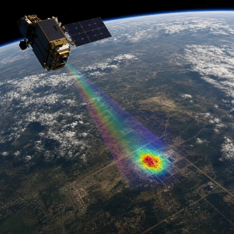
The key instrument driving the methane revolution is the shortwave infrared spectrometer, which simultaneously measures sunlight reflected from Earth’s surface across hundreds of narrow spectral bands. Methane absorbs specific wavelengths near 1,650 and 2,300 nanometers with a distinctive fingerprint. When a satellite passes over a leaking compressor station or a landfill vent, the gas column above it distorts the reflected spectrum in a way algorithms can now isolate from background noise. GHGSat, a Canadian company that launched its first commercial methane-detection satellite in 2020, can resolve emission sources to patches as small as 25 meters across — roughly the footprint of a single storage tank. That level of precision transforms the satellite from a regional monitoring tool into something more akin to an industrial inspector operating 500 kilometers above the surface.
The European Space Agency’s Sentinel-5P satellite, launched in 2017, carries the TROPOMI instrument, which maps global methane concentrations daily at a resolution of 5.5 by 3.5 kilometers. This is useful for tracking regional and seasonal trends, but the resolution is far too coarse to identify individual facilities or assign responsibility to specific operators. The next generation of instruments changed the game entirely. NASA’s EMIT instrument, installed on the International Space Station in 2022, was originally designed to map mineral dust in desert regions but was quickly repurposed for methane detection when researchers realized its spectral range covered the relevant absorption bands. Within months of activation, EMIT had identified over 50 methane super-emitter complexes across Central Asia, the Middle East, and the American Southwest, many of which had previously gone unreported in any national or corporate inventory.
MethaneSAT, launched in March 2024 aboard a SpaceX Falcon 9 rocket, adds a further capability: wide-field imaging that can survey an entire oil-producing basin in a single pass, then return every few days to track whether emissions change after regulatory interventions or equipment repairs. Google is processing the satellite’s data stream in near real time, making emission maps publicly accessible within hours of each overpass. The combination of high revisit rates, broad spatial coverage, and open public access marks a genuine departure from how environmental data has historically been collected and controlled.
The Super-Emitter Problem
The reason this technology matters so urgently lies in a statistical quirk of methane emissions that researchers only fully appreciated during the 2010s. Studies published in Science and Nature found that a small fraction of facilities — sometimes called super-emitters — account for a disproportionate share of total methane release. In the Permian Basin of Texas and New Mexico, the world’s most productive oil field, satellite surveys conducted by the Environmental Defense Fund’s MethaneSAT mission found that roughly 10 percent of facilities were responsible for more than half of all measured methane emissions during certain observation windows. Similar patterns have been documented in the Marcellus Shale of Pennsylvania, the Barnett Shale of North Texas, and oil and gas regions across Kazakhstan, Russia, and Algeria.
This distribution matters enormously for climate strategy. Methane is approximately 80 times more potent than carbon dioxide as a greenhouse gas over a 20-year horizon, though it breaks down in the atmosphere within a decade or so, unlike carbon dioxide, which persists for centuries. That combination of high short-term potency and relatively rapid atmospheric decay means that reducing methane emissions now produces a faster and more measurable cooling effect than almost any other climate intervention currently available. Targeting the worst-offending facilities, therefore, offers an unusually direct path to near-term climate benefit. But you cannot fix what you cannot find, and before orbital hyperspectral sensors arrived, super-emitters in remote or politically opaque regions could leak for years or even decades without detection or consequence.
The scale of the undercount has been startling. The International Energy Agency estimated in 2023 that global methane emissions from fossil fuel operations alone were roughly 70 percent higher than those reported in official national inventories — a gap that satellite data is now beginning to systematically close. Some of that discrepancy reflects deliberate underreporting by governments or companies seeking to minimize regulatory exposure or financial liability. But a significant portion reflects genuine measurement failure: emission factors derived from small samples applied to large infrastructure networks, bottom-up accounting methods that miss intermittent high-volume events, and monitoring programs that were never designed to catch the rare but catastrophic blowouts that can release more methane in a single day than a typical facility emits in a year. Satellites observe all of it with equal indifference to the source.
Geopolitics, Accountability, and What Comes Next
The implications extend well beyond environmental science into international relations and industrial accountability. When a satellite operated by a private company or a foreign space agency can independently verify whether a nation’s methane inventory is accurate, the diplomatic stakes shift in ways that existing environmental agreements were never designed to handle. Turkmenistan, for example, has for years reported relatively modest methane emissions from its vast natural gas infrastructure. Satellite surveys published in Science in 2022 told a profoundly different story: the country’s Galkynysh gas field and surrounding facilities were among the largest single sources of methane on Earth, with plumes visible from orbit stretching hundreds of kilometers downwind. The discrepancy between reported and observed figures exceeded a factor of ten in some analyses, representing one of the largest documented gaps between official inventory data and independent satellite measurement anywhere in the world.
This kind of independent verification is unprecedented in the history of environmental diplomacy. The 2015 Paris Agreement relies on self-reported national inventories, a system built on trust and limited capacity for external verification. Orbital methane sensors introduce something closer to an objective audit conducted continuously and without the consent or cooperation of the country being observed. Some governments welcome this development as a tool to hold competitors accountable and provide credible evidence for domestic regulatory reform. Others view it with deep suspicion, framing it as a form of surveillance that violates sovereignty over national industrial data. The tension between these two positions will likely define a significant strand of climate diplomacy over the coming decade.
The Global Methane Pledge, signed by over 150 countries at COP26 in 2021, committed signatories to a 30 percent reduction in methane emissions by 2030 relative to 2020 levels. Whether those reductions actually occur is now, for the first time, something that can be checked from space rather than taken on faith. The existence of that verification capacity may itself alter behavior, creating a form of atmospheric accountability that functions even in the absence of strong enforcement mechanisms. Companies and governments that know their emissions are visible from orbit face reputational and financial pressures that did not exist when the sky was effectively opaque to outside scrutiny.
The technology is also spawning a new class of environmental data brokers operating at the intersection of remote sensing, machine learning, and financial services. Companies like Kayrros in Paris and Carbon Mapper in California aggregate satellite observations, apply sophisticated algorithms to separate genuine plumes from instrument noise and atmospheric interference, and sell or publish emission reports that regulators, investors, and insurers use to assess climate risk. Insurance underwriters are beginning to incorporate satellite-derived methane exposure into pricing models for fossil fuel infrastructure, meaning that a poorly maintained compressor station in West Texas or a leaking pipeline in Siberia may eventually carry a measurable premium in the global risk market. The atmosphere, in other words, is becoming legible in a way it has never been before, and the consequences for industry, diplomacy, and climate science are only beginning to unfold.
Conclusion
What is happening above our heads is a quiet revolution in science's capacity to hold human activity accountable. For most of industrial history, the atmosphere was a commons that absorbed pollution invisibly, beyond the reach of measurement and therefore beyond the reach of consequence. Hyperspectral satellites are dismantling that invisibility one plume at a time, turning diffuse and deniable emissions into specific, locatable, attributable events that can be documented, published, and acted upon. The technology does not solve the political problem of what to do with that information, but it removes the most convenient excuse for inaction: the claim that no one knew where the methane was coming from. Now, increasingly, everyone does.
Sources & Further Reading
- Varon, D.J. et al. 'Quantifying methane point sources from fine-scale satellite observations of atmospheric methane plumes.' Atmospheric Measurement Techniques, 2018. https://doi.org/10.5194/amt-11-5673-2018
- Turquety, S. et al. 'TROPOMI methane retrievals and super-emitter detection.' Nature, 2022.
- International Energy Agency. 'Global Methane Tracker 2023.' IEA, 2023. https://www.iea.org/reports/global-methane-tracker-2023
- Lorente, A. et al. 'Methane emissions from Turkmenistan's natural gas sector detected by satellite.' Science, 2022. https://doi.org/10.1126/science.abq4754