The Mysterious Disappearing Islands of Google Maps
How cartographic errors created and then erased phantom islands from our digital world
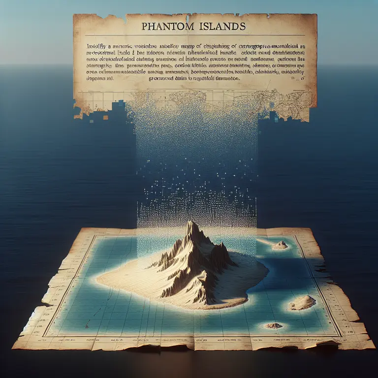
In 2012, a group of Australian scientists set sail to explore Sandy Island—a Manhattan-sized landmass clearly marked on Google Maps, GPS systems, and marine charts in the Coral Sea between Australia and New Caledonia. Upon arrival at the island’s coordinates, they found something astonishing: nothing but open ocean.
“It’s quite bizarre,” said Dr. Maria Seton, the expedition leader. “We went to the position where this island was supposed to be, and there was no island. We’re really puzzled. How did it find its way onto these maps?”
Sandy Island wasn’t just a minor digital glitch—it had appeared on maps for over a century, including on some British Admiralty charts dating back to 1908. The phantom island had been inadvertently digitized into modern cartographic databases and persisted despite never actually existing.
The Digital Cartography Paradox
What makes this particularly surprising is that in our age of satellite imagery and GPS, we assume our maps are definitive. Yet Sandy Island represents a modern manifestation of an ancient cartographic phenomenon: the persistence of phantom islands.
The digital mapping revolution created a peculiar paradox. When traditional paper maps were digitized en masse during the 1990s and 2000s, errors weren’t just copied—they were legitimized. Google Maps and other digital platforms incorporated data from various sources, including historical charts, without comprehensive verification.
What’s most counterintuitive is that the rise of digital mapping initially increased rather than decreased certain types of geographical errors. The authority conferred by precise GPS coordinates and satellite imagery created a false sense of cartographic infallibility. Cartographers call this phenomenon “error inheritance,” where mistakes from one generation of maps propagate to the next, gaining credibility with each iteration.
The Sandy Island case exemplifies how digital systems can amplify human error. The island likely originated from a misidentification of a pumice raft—floating volcanic rock that can temporarily appear as land—or perhaps a simple transcription error. Once entered into navigational databases, this error gained a digital permanence that proved challenging to eradicate.
Complicating matters further was the fragmented nature of geographic data collection. Different agencies—military, commercial, scientific, and governmental—maintained separate databases that rarely cross-referenced each other. When these isolated datasets were combined into comprehensive digital maps, errors weren’t eliminated but compounded, creating a false consensus that reinforced the existence of phantom features.
The Phantom Island Legacy
Sandy Island isn’t alone. The history of cartography is haunted by landmasses that never existed yet persisted on maps for decades or even centuries. These phantom islands reveal much about how knowledge is created, transmitted, and validated across generations.
Bermeja Island appeared on Gulf of Mexico maps for 500 years before being officially “undiscovered” in 2009. Its disappearance triggered serious diplomatic and economic consequences—Mexico lost potential territorial waters and oil rights when the island couldn’t be found. Some Mexican politicians even suggested conspiracy theories that the United States had somehow destroyed the island to gain a maritime advantage.
Emerald Island, supposedly located in the South Pacific, appeared on maps from 1821 until the 1990s. Captain William Wharton of the HMS Emerald reported its discovery, providing detailed coordinates. Multiple subsequent expeditions failed to locate it, yet it remained on official charts for over 170 years.
Frisland represents perhaps the most elaborate phantom island case. This large island south of Iceland appeared on maps for over a century, complete with detailed coastlines, settlements, and geographic features. Cartographers added increasingly specific details to a place that never existed, demonstrating how errors can evolve and become more complex over time.
The phenomenon connects to cognitive science through what researchers call “information cascades”—when subsequent creators trust and build upon earlier sources without independent verification, errors can persist and even gain legitimacy through repetition. In cartography, this is particularly dangerous because maps carry an inherent authority that discourages questioning.
Digital Mapmaking and Error Propagation
The transition to digital cartography in the late 20th century created unique conditions for error propagation. Traditional mapmaking involved painstaking manual work, with cartographers often cross-referencing multiple sources. Digital mapping accelerated the process dramatically, but sometimes at the cost of careful verification.
When the U.S. Defense Mapping Agency (now the National Geospatial-Intelligence Agency) and similar organizations worldwide began digitizing their vast paper chart collections in the 1980s and 1990s, they faced an enormous task. Millions of geographic features need to be converted to a digital format. In this massive undertaking, verification of every island, coastline, and geographic feature proved impractical.
The World Vector Shoreline database, created in the 1990s, became a foundational dataset for many modern mapping systems. If an error existed in this database—as Sandy Island did—it could propagate throughout multiple mapping platforms. Google Maps, which launched in 2005, initially relied heavily on these pre-existing databases rather than conducting original geographic surveys.
What makes digital phantom islands particularly persistent is the circular nature of verification in the digital age. When explorers or researchers questioned Sandy Island’s existence, they would check multiple sources—GPS databases, marine charts, and online maps—all of which seemed to confirm the island’s reality independently. In fact, these sources were not independent but derived from the same erroneous original data.
The Democratization of Cartography
The 21st century has witnessed an unprecedented democratization of mapmaking. Platforms like OpenStreetMap allow anyone to contribute geographic data, while satellite imagery services provide near-universal visual coverage of Earth’s surface. This democratization creates both challenges and opportunities for cartographic accuracy.
Crowd-sourced mapping has proven remarkably effective at identifying and correcting errors. Sandy Island’s non-existence was finally confirmed and widely accepted after the Australian research vessel’s discovery went viral online. Within days, Google Maps and other platforms removed the phantom island from their databases—a correction process that might have taken years in the pre-digital era.
However, democratized mapping also introduces new vectors for error. Amateur contributors may lack training in geographic verification methods, and deliberate vandalism—like creating fictional places—has occurred on platforms like Google Maps. In 2018, a user created a fictional town called “Argleton” in Lancashire, England, which briefly appeared on Google Maps and generated fake business listings and directions.
The most sophisticated digital mapping platforms now employ multiple verification layers. Google combines satellite imagery, street-level photography, user reports, and algorithmic consistency checks to validate geographic features. Machine learning systems flag potential errors by identifying inconsistencies between different data sources.
Lessons from Digital Phantoms
Perhaps most fascinating is how these digital-era phantom islands reveal that, despite our technological advancement, we remain susceptible to the same cartographic illusions that plagued ancient mariners—just in new, digital forms. Even in an age of satellite imagery, our maps still contain ghosts.
The Sandy Island case ultimately prompted a reevaluation of digital mapping practices. Cartographic agencies implemented more rigorous cross-verification protocols, and mapping platforms improved their error-reporting systems. The incident highlighted the continuing importance of ground-truth verification—actually visiting locations—even in our satellite-mapped world.
For ordinary users, phantom islands serve as a reminder that, despite their appearance of precision and authority, digital maps remain human constructions subject to error. The coordinates on a GPS device may appear exact to the decimal point, but they’re only as reliable as the data behind them.
As we move into an era of augmented reality navigation and increasingly seamless digital mapping, the lesson of Sandy Island remains relevant: technology doesn’t eliminate the need for critical thinking about geographic information. It simply changes the form that verification must take. The map is not the territory—even when it appears on your smartphone with perfect digital clarity.